Scenic Drives around the World
The Great Ocean Road, Australia
Information: Visit Great Ocean Road
The Great Ocean Road passes arresting natural rock formations such as Loch Ard Gorge and the Twelve Apostles. It's a coastal thruway not to be missed by relaxed road trippers enjoying clear skies. Much of the road hugs coastline between Torquay and Cape Otway, and the Shipwreck Coast further west of Cape Otway, providing visibility of Bass Strait and the Southern Ocean. <Map>
If you want to stretch your legs, there is the Great Ocean Walk connecting 104 km of walking trails that follow the coastline near the Great Ocean Road, stretching from Apollo Bay to the 12 Apostles.
Distance: 400 km (240 miles)
La Route Des Grandes Alpes, France
Information: Grande-Traversee-Alpes
Wild and magnificent, Route des Grandes Alpes is a legendary mountain road running from the mountains to the sea, across the French Alps. This fabulous route takes you from lake Leman (near Geneva) to the Mediterranean (Nice- French Rivera) climbing 16 passes that are among the highest in the Alps.
This is a remarkable tourist itinerary with exceptional natural and cultural environment. The road tops out at 2.802 m (9,193ft) above sea level. It can be covered in a couple of days by car.
-
<Col d'Eze> <Col d'Izoard> <Col de Castillon>
<Col de l'Iseran> <Col de La Bonette>
<Col de La Cayolle> <Col de La Colombière>
<Col de La Couillole> <Col de La Croix De Fer>
<Col de La Madeleine> <Col de Turini>
<Col de Vars> <Col des Aravis <Col des Gets>
<Col des Saisies> <Col du Galibier>
Snowbound in winter, it's a midsummer drive on some of the highest roads in Europe traversing varied geological landscapes and ecosystems. So scenic that you will see bikers periodically. It also hugs the Swiss and Italian borders so feel free to explore off route.
Distance: 720 km (430 miles)
Haines Highway, Alaska
Information: Golden Circle Route
The Haines Highway is one of the most spectacular drives in the North. In 2009 it was awarded the distinction of National Scenic Byway. It essentially follows the trail used by the Chilkat / Tinglit First Nations who traded with the Athabascan First Nations in the interior of the Yukon. It is now part of the “Golden Circle Route” which links Whitehorse, Skagway, Haines and Haines Junction.
This route (map) includes a one-hour ride on the Alaska Marine Highway between Haines and Skagway.
Distance: 247 km, (150 miles)
Oregon: Pacific Coast Highway, Route 101
Information: Oregon Coast Scenic Highway
Route 101, Oregon has some of the most beautiful roads, not the least of which is the Historic Columbia River Highway, but the combination of waves on rocks and trees on hills stretching on for miles is that hard to beat.
The Oregon coast is home to isolated beaches, rugged cliffs with breathtaking views of the Pacific and quaint seaside towns.
Distance: 584 km, (363 miles)
St. Lawrence Route, Quebec
Information: St. Lawrence Route
The St. Lawrence Route located on Highway 362 links Baie-Saint-Paul to La Malbaie (southern Quebec's Charlevoix region). The drive begins in Québec City and continues along the north shore of the St. Lawrence River, ending in the town of La Malbaie, just short of Tadoussac.
This scenic drive takes you through picturesque towns and villages that sit upon the St. Lawrence River with mountains as a backdrop. There are lots of places to stop along the way.
Charlevoix attracts visitors because of its agriculture tourism, regional farm-to-table cuisine and arts/culture. The final stop on the route, Malbaie, is home to the famed Manoir Richelieu, one of Canada's historic railway hotels, owned by Fairmont Hotels.
Distance: 155 km, (90 miles)
<Map>
Utah Scenic Byway, Route 12
Information: Utah Route 12
This is 122 miles of spectacular driving. Utah’s Scenic Byway 12, is also designated an All-American Road. Only one-third of America’s scenic byways get this distinction.
The scenic byway connects U.S. 89 near Panguitch on the west with S.R. 24 near Torrey on the northeast. The whole drive can be completed in three (3) hours if you're just passing through.
A stop at the scenic overlook near the road’s summit at about 9,000 feet puts it all into perspective. The road hits the pavement of the Henry Mountains, Grand Staircase–Escalante, the shimmering red rock of Capitol Reef National Park and comes close to Bryce Canyon N.P.
Travel book: Fodor’s The Complete Guide to the National Parks of the West.
Distance: 204 km, (122 miles)
Norwegian Fjords
Information: Drive the Fjords
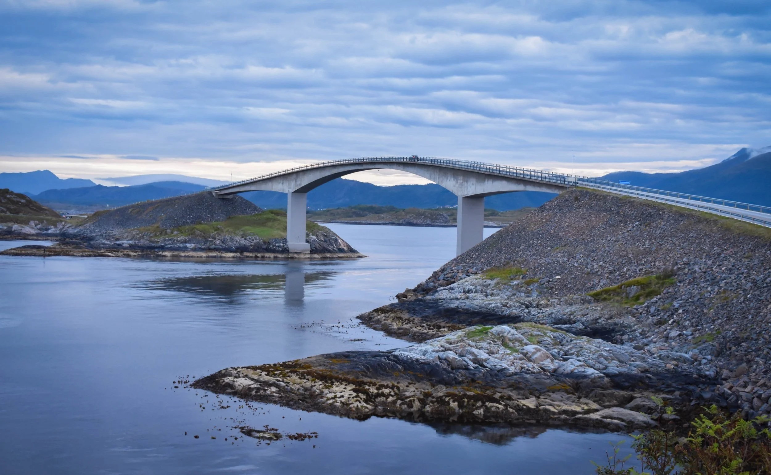
You travel from Bergen to Trondheim along fjords, mountain landscapes and waterfalls. The drive goes through the longest road tunnel in the world, climbs the troll path and take the spectacular Atlantic Road over the ocean.
The easiest way to experience this journey is to fly to Bergen, rent a car, do the road trip and fly back home from Trondheim.
Distance: 860 km, (533 miles)
Road to the Isles, Scotland
Information: Road to the Isles Guide
The Road to the Isles (also known as A830), is a road in Lochaber, in the Highlands of Scotland, which connects the town of Fort William to the port of Mallaig from where a ferry can be taken over the sea to Skye.
The Road to the Isles is a 46-mile (80km) scenic drive that takes in historic sites as well as beautiful Scottish countryside. At Morar you can enjoy the white sands of the almost tropical beach. Adding to the picturesque nature of the route is the occasional sighting of the Jacobite steam train – a world famous railway ride in that takes you over the Glenfinnan Viaduct, best known for its role in the Harry Potter films.
Distance: 80 km, (46 miles)
Wales Way, United Kingdom
Information: The Wales Way Drive
The Wales Way, is three (3) national routes – the Coastal Way, the Cambrian Way and the North Wales Way – which guide you through some of the country’s most striking scenery. Each touring route is designed to introduce visitors to the best of Wales.
The Coastal Way travels the west coast around Cardigan Bay, a 180-mile (290km) road-trip between the sea and mountains.
The Cambrian Way crosses the spine of Wales for 185 miles (300km) between Llandudno and Cardiff, through National Parks and big green spaces.
The North Wales Way leads 75 miles (120km) past mighty castles into the island of Anglesey.
Distance: 440 miles, (710 km)
Milford Road, South Island, New Zealand
Information: The Milford Road
Not only one of the most scenic roads in New Zealand, the Milford Road is one of the most scenic roads in the world. Beginning at Te Anau, this stretch of highway heads deep into the remote Fiordland National Park, eventually leading you to awe-inspiring Milford Sound. This windy road is incredibly dramatic and takes you through some of the most impressive landscapes you’ll see including glacier-carved valleys, the reflective Mirror Lakes and dense, lush rainforest.
Distance: 120 km, (75 miles)
The Garden Route, Western Cape, South Africa
Information: The Garden Route
The Garden Route is a 300-km stretch of the south-western coast of South Africa which extends from Mossel Bay in the Western Cape to the border of Tsitsikamma Storms River. The Garden Route runs parallel to a coastline featuring lakes, mountains, tall indigenous forests, amber -colored rivers and golden beaches. < Map >
Distance: 300 km, (180 miles)
Hokkaido's Scenic Byways, Japan
Information: Japan Byways
Hokkaido is one of Japan's four main islands, and many people also consider it to be the most beautiful.
It's packed with volcanoes, caldera lakes, snow-capped peaks, beaches, and geothermal springs. Tourists can get a real feel for Hokkaido's diverse scenery by driving the island's series of scenic byways, which showcase the coast, the mountains, and the colorful farms in between. It is Japan’s final frontier, where bears roam and sea lions thrive.
The main National Parks are:
Akan National Park - within a couple of hours of Kushiro (Kushiro is a transportation point for Eastern Hokkaido sightseeing), you’re surrounded by patches of Sakhalin fir trees and wide-girth yezo spruce.
Shiretoko National Park - is a volcanic peninsula with a primeval fir forest that hosts a healthy brown bear population.
Daisetsuzan National Park - more mountainous than Hokkaido’s other national parks, Daisetsuzan has a wide variety of hiking trails.
There are a total of six (6) routes. <Learn more> <Map of Routes> <Drive time and distance>
Nha Trang to Qui Nhon, Vietnam
Information: <Nha Trang> <Qui Nhon>
The famous Hải Vân Pass that follows the coast from Hue to Da Nang gets most of the attention when it comes to scenic road trips in Vietnam, but the stretch of Highway 1 that connects Nha Trang to Qui Nhon, further down the coast, is just as epic (and less touristy, to boot). it's got mountain scenery on the inland side and stunning sea views with golden beaches on the ocean side.
Distance: 216 km (134 miles), <Route>
Carretera Austral, Route 7, Chile
Information: Carretera Austral
The Carretera Austral <map> is a stretch of “road” almost 1200 km (800 miles) long from Puerto Montt to Villa O’Higgins in Patagonia.
The route takes you through untamed landscapes. This part of Chile is still very primitive and wild with postcard scenery. One moment the road will be fringed with lush, dense forests and the next you will be driving through stark, rugged wilderness with snow-capped mountains forming the backdrop. The entirety of the area is sparsely populated and little traffic.
Distance: 1200 km, (800 miles)
Ruta 40, Argentina
Information: Ruta 40
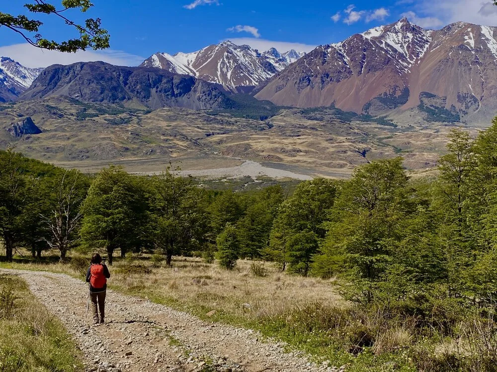
Winding its way from the top of Argentina to the southern tip, Argentina’s Ruta 40 is one of the longest stretches of highway in the world, covering more than 4100 km (2500 miles).
Most of the highway runs alongside and sometimes within the Andes Mountain range, passing through some of the most amazing landscapes on the planet and connecting to the country’s national parks.
One of the best sections (weather permitting) is that of the Fitzroy and Cerro Torres ranges in when you get close to El Chalten in Southern Patagonia.
Distance: 4100 km, (2500 miles)
Pacific Coast Highway, California
Information: travelwildnow.com
State Route 1 (or Pacific Coast Highway) is a major north–south state highway that runs along most of the Pacific coastline of the U.S. state of California. At a total of just over 656 miles (1,056 km), it is the longest state route in California.
The highway is designated as an All-American Road.
The route starts in historic Monterey, visits the art colony of Carmel, and threads through Big Sur, where mountains plunge into the Pacific.
Bixby Bridge is the most photographic spot. The bridge is a single-span concrete arch more than 260 feet (80 meters) high and 700 feet (200 meters) long. Park at turnouts near either end to gawk or take pictures. Ahead, the highway passes Hurricane Point, a place of big winds and big views.
Distance: 656 miles (1,056 km)
Resources: Lonely Planet, wikipedia.orgNo copyright infringement is intended on this website by travelwildnow.com


