Our Picks:
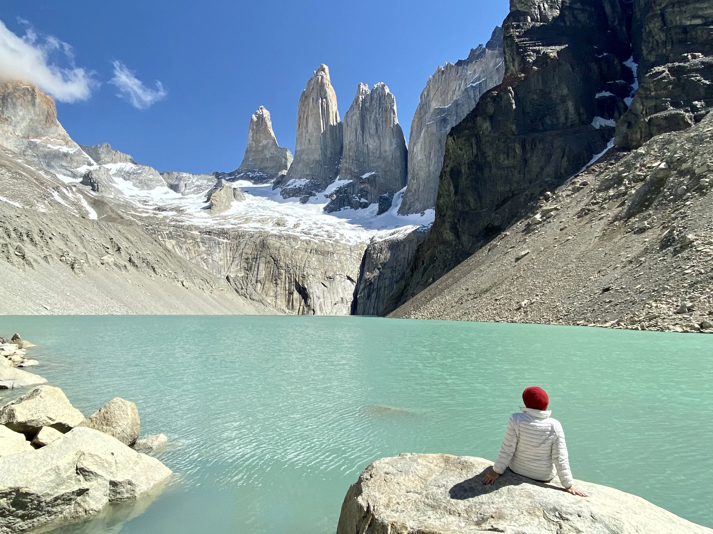
The Towers, Torres Del Paine, Chile
Distance: 20 km (12 mi) 7-9 hr. RT
Difficulty: moderate, (difficult just before approaching The Towers)
Some call the Towers the eighth wonder of the world. The area encompasses mountains, glaciers, lakes and rivers.
Starting at Hotel Las Torres <Map> the Towers trail takes about 7-9 hours round-trip for most people, with an elevation gain of about 750-800 meters.
Start first thing in the morning and bring plenty of water and protein bars. The weather can change several times before you even reach the Towers. Bring gear for rain, wind and cold.
Source: chile.travel
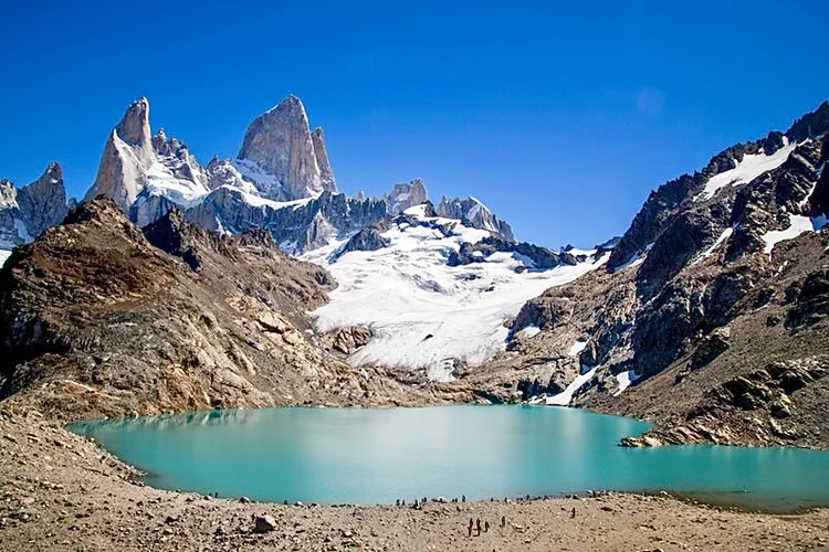
Fitz Roy, Patagonia
Distance: 24 km (14 miles) 8 hrs. RT
Difficulty: moderate
Fitz Roy, Argentina (also known as Laguna Los Tres, route), is famous for views of beech forests, open plains, glaciers, waterfalls and the iconic Fitz Roy Massif.
Starting in El Chaltén, Argentina, this hiking trail offers the best views of Fitz Roy and the surrounding glaciers, but it’s also the hardest and longest of the day-hikes.
AllTrails - great app to have for any trek.
South Kaibab Trail, Grand Canyon, Arizona
Distance: 10 km (6 Miles) RT, 5 hr. Hike to Skeleton Point, & return.
Difficulty: moderate
The South Kaibab Trail, the best and least traveled of the two maintained Grand Canyon South Rim paths begins along the side road to Yaki Point. For an amazing DAY HIKE, we suggest trekking to Skeleton Point and return back. You get to see the view of the Colorado River.
South Kaibab Trail to Skeleton Point is a 6 mile heavily trafficked out and back trail.
WARNING: The National Park Service strongly recommends not to venture pass Skeleton Point for a DAY HIKE.
Source: nps.gov/grca
Landmannalaugar, Iceland
Distance: various day trails, 2-10 km (1-6 miles) loops
Difficulty: easy to moderate
Landmannalaugar is a truly rare geological area. It is made up of windswept rhyolite mountains, a rock type that creates a full spectrum of dazzling colors. Shades of red, pink, green, blue and golden yellow make for an exquisite location.
If you elect to self-drive, you must rent a 4x4 vehicle. Access is easiest driving the F 208 road from the north.
F roads are defined as windy, mountainous, gravel roads with no bridges and with river crossings.
Regular rental cars are not allowed on F roads. Alternatively, there are several bus transfer options to Landmannalaugar.
The window for hiking is small, from approximately mid-June to mid-September (weather dependent). At other times of the year the roads to the highlands are impassable.
Source: Guide to Iceland.
Fimmvorouhals Trail, Iceland
Distance: Start Skógafoss to the Canyon of Waterfalls, 10 km one way. Duration: 4-5 hours
Difficulty: easy to moderate
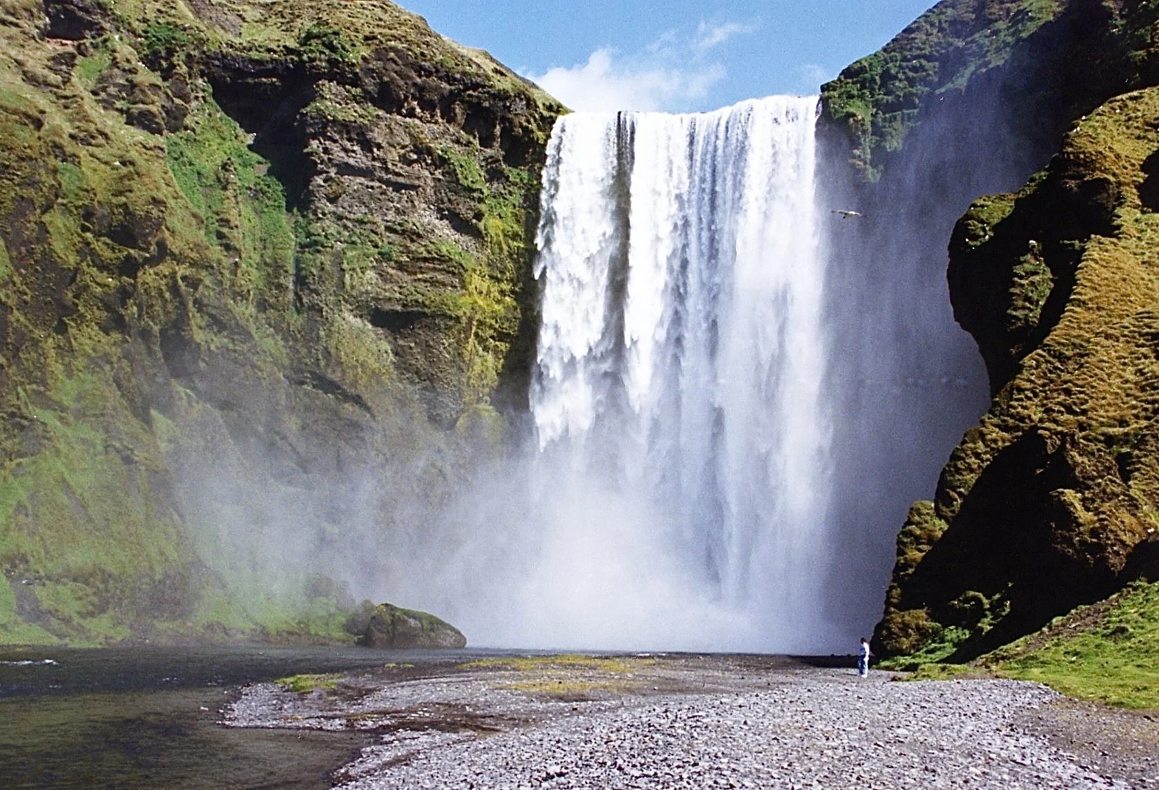
A great one-day hike that presents the best of Iceland into a single trek. The Fimmvörðuháls trail takes you through some of the most dramatic scenery Iceland has to offer, from a series of canyon waterfalls to a volcanic moonscape.
Start your hike at Skogafoss, one of Iceland’s most famous waterfalls. Continue through a green valley with over 26 dramatic waterfalls. For a scenic DAY HIKE, you turn around at the end of the waterfall path.
If you desire to trek the entire way to Thorsmork, you must camp overnight at mountain huts, as the out and back take 2-3 days. Tour operators do offer this option.
Sossusvlei trails & climbing the Dunes, NAMIBIA
Distance walking the Vlei: 2-7 km (1 mi.- 4mi), 3 hr.
Climbing the Dunes: 40 min.- 1.5 hours one way to top, much easier coming down.
Difficulty: moderate
Sossusvlei, situated within the Namib-Naukluft National Park, is characterized by its famous orange sand dunes and white salt pans.
The main trails are Deadvlei, Hidden Vlei, and Sossusvlei. Deadvlei is a white clay pan and probably the most famous and photographed in Sossusvlei. Hidden Vlei is a 4km round walk from the 2WD car park.
Among the Dunes that visitors climb are Dune 45 and Big Daddy (the highest one).
KEY SUMMIT TRAIL, NEW ZEALAND (South Island)
Distance: 8 km (5 mi.) RT, 3-4 hrs.
Difficulty: moderate
This walk offers spectacular views of Fiordland National Park. If you only have time for one walk on your drive to Milford Sound, and the weather is fine, this track is well worth the effort.
The self-guided alpine walk passes a range of native vegetation: beech forest, sub-alpine shrublands, alpine tarns and bogs. Birdlife is prolific and tomtits, robins, New Zealand pigeons and bellbirds are commonly seen.
From The Divide carpark: follow the Routeburn Track for about one (1) hour to get to Key Summit Track. From here it is a 20-minute climb to Key Summit, with panoramic views.
Source: www.doc.govt.nz/park
TONGARIRO ALPINE CROSSING, NEW ZEALAND (North Island)
Distance: 20 km (12 miles), 7-9 hrs.
Difficulty: moderate
The trail runs through an active volcanic region with great views of the Red Crater, the Emerald Lakes and the Blue Lake. <photo gallery>
Tongariro N.P. can be subject to unpredictable weather and conditions can change quickly. It is important that all walkers carry the essentials for their journey across.
NOTE: You may OPT to just do PART or all of the trek. Whichever distance you decide, it will be a rewarding experience. <Learn more about the track>
Parking awareness: There is now a 4-hour parking restriction in place at the Mangatepopo road end, to allow for those doing shorter walks. However, for those hiking the entire Tongariro Alpine Crossing, there are frequent shuttles that will pick you up at the “end of trail” and return you to your starting point.
Source: www.tongarirocrossing.org.nz
Kalalau Trail, Kauai, Hawaii
Distance: 18 km (11 miles), one way
Difficulty: moderate, Note: it can get muddy and slippery after a rain shower or storm.
This amazing coastal hike takes you on steep trails and tropical heat as you trek through striking jungle, beautiful waterfalls and explore the mile-long arc of Kalalau Beach.
The trail curves in and out of the many ridges that reach to the ocean and then slowly works its way back down to Hanakapi'ai Beach, which is the halfway point.
WARNING: you should NOT go any further than “ 3 miles “ ONE WAY if you are NOT camping overnight. Turn around for an enjoyable day hike experience.
Plain of the Six Glaciers Trail, Lake Louise, Alberta, Canada
Distance: 14 km (8.4 mi.) out and back, 5 hours.
Difficulty: moderate
Elevation Gain: 1,770-ft. to Plain of the Six Glaciers Viewpoint
The hike begins at Lake Louise and offers fantastic views of the surrounding mountains and the majestic turquoise Lake Louise.
The trail brings you to a picturesque and adorable mountain tea house stocked with freshly baked scones, pies, cakes, sandwiches and (of course) a signature blend of tea.
VALLE DE LA LUNA, ATACAMA DESERT, CHILE
Various short scenic trails.
Difficulty: easy
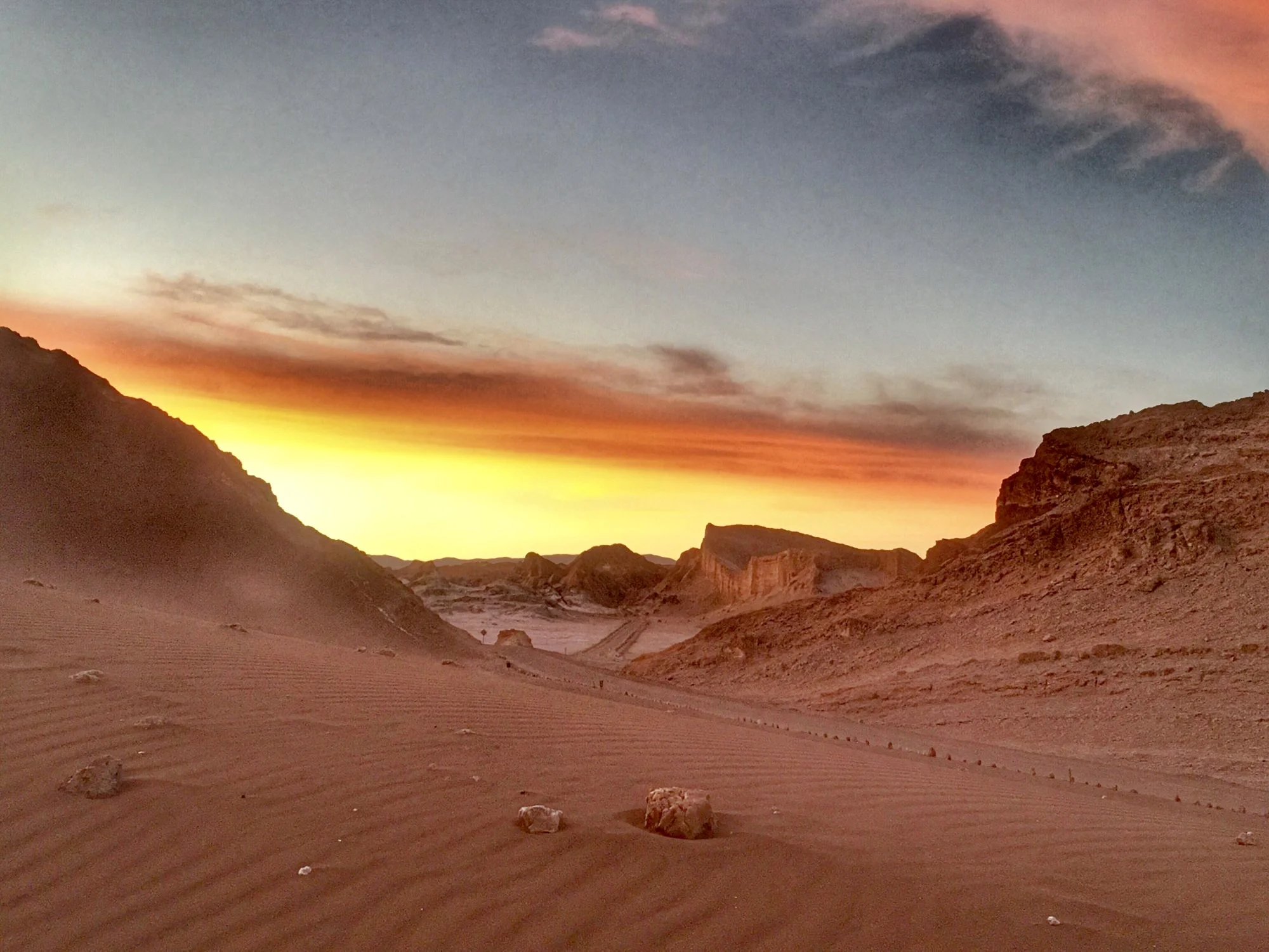
The area consists of strange rock formations and dunes of the Valley of the Moon. Elements such as wind and water have carved out some unique landscapes which has led to some amazing colors, shapes and textures across the Valle de la Luna.
You cannot miss the SUNSET in the Atacama Desert. It is an amazing sight with beautiful colors in the twilight.
There are various short trails with the opportunity to see salt caves, distinctive rock formations, sand dunes and finish with the sunset over the lunar valley.
Source: chile.travel
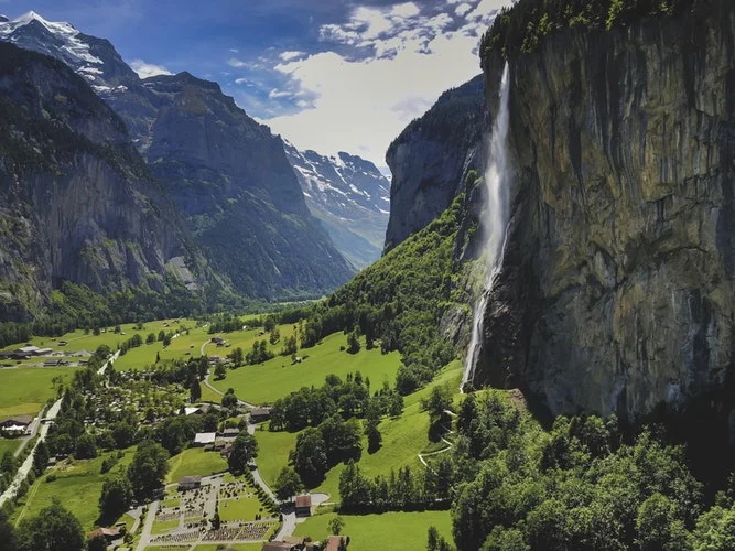
LAUTERBRUNNEN, SWITZERLAND
Distance: 3 km (1.8 miles), 3-4 hrs. one-way
Difficulty: moderate
Trekking Lauterbrunnen to Wengen via Mendelssohnweg offering amazing views of the Swiss Alps.
The trail is a continuous uphill, so another option is taking the train up to Wengen and then walk back downhill.
A great walk if you are looking to get your heart beating as it ascends most of the way. This walk will take you through the forest, views of the Majestic Alps and waterfalls cascading into the Lauterbrunnen valley.
CRADLE MOUNTAIN, TASMANIA
Distance 15 km (9 mi.) RT, 5 hrs.
Difficulty: easy to moderate
The jagged contours of Cradle Mountain, a wild landscape, an ancient rainforest and alpine heathlands/button grass provides a range of environments to explore.
From Ronny Creek Parking lot, follow trail to Marions Lookout. The scenic route to Marions Lookout is via Lake Lilla and Wombat Pool. <Detailed information / map>
Another scenic easy hike is at Cradle Valley Board Walk: Cradle Mountain Visitor Centre to Dove Lake, about 3 hours in total.
Source: trailhiking.com.au
BWINDI GORILLA TREK, UGANDA
Distance varies; 4-7 km (2-4 mi), 2- 8 hrs.
Difficulty: difficult, must be in good physical condition.
The length of the trek is unpredictable as it depends on several factors especially on the nature of gorilla habitat and location of gorillas in the wild.
A trek to see a group of these magnificent creatures may take you about 2 to 8 hours. Gorilla treks are generally strenuous and you need to be physically fit. You will be required to hike through the steep slopes and thick rainforest in search of these rare apes in their natural habitat. They thrive mainly at altitude of about 2200 to 4300 meters.
<Trekking is only thru advanced purchase of PERMITS and with a official guide>
Source: Uganda Wildlife Authority
THREE CAPES TRACK, TASMANIA
Distance: 48 km total trek, Short day treks available.
Difficulty: easy to difficult, depending on section of trek
Few places on Earth remain that feel so remote, so raw, so removed from the ordinary world.
A must-do Cape Raoul with its dramatic dolerite cliffs. Walk to stunning Cape Hauy to view the famous ‘Candlestick’ and ‘Totem Pole’ sea stacks and continue to the gorgeous Tasman Coastal Track, between Waterfall and Fortescue Bays, with its lush rainforest and breathtaking coastal views.
Four days and three nights on a track so meticulously crafted you’re free to enjoy your experience rather than watching every step. Look up, look out, look within.
Source: threecapestrack.com.au
MOHARE DANDE GHANDRUK TREK, NEPAL
Difficulty: easy to moderate
Thou this is NOT a day hike, it is worth mentioning due to the spectacular scenery and given the main activity in Nepal is trekking.
This trek is one in which a reasonably physical fit person or family can enjoy.
The Mohare Danda trek is arranged by a tour operator and is a 4-5 day trek experience.
Mohare Danda Trek (Eco Community Lodge trek) takes you to the peaceful off beaten path in the Annapurna’s foothills. The region promotes sustainable eco-tourism of Nepal and supports local community projects.
It is the best choice for those enthusiasts’ travelers who have a short time to explore the cultural and natural beauties of Nepal.
Mohare trek provides the closet view of Mount Annapurna and Dhaulagiri range. The area is bounded by hills, mountains, rivers and forest of Bamboo and Oak, in a truly incredible environment.
Source: Adventure Treks Nepal
LYCIAN WAY TRAIL
Fethiye to Antalya, Turkey
Distance: 500 km - one way
<Route> <Location>
The Lycian Way is over 500 km (310 mi) in length, stretching from Fethiye in the west to Antalya Province in the east. The well-marked trail winds along the mountainous coastline, dipping into centuries-old ruins and ancient cities along the way. Historic sites are everywhere.
Learn more about the Lycian Way Trail. <Location>
Just doing a small part of this trail is definitely rewarding. Just pick your spot.
Some parts of the Lycian Way are suitable for trail riding with mountain bikes. In some places, experienced downhill and single-track enthusiasts can pass the entire track by carrying the bike on the back. However, it is also possible to try the bicycle route, which is partly on the Lycian Way and on parallel side roads, by using alternative forest and village roads.
The trail is part of the stunning Turquoise Coast. If trekking is not in your interest, check out Wilderness Travel”s expedition, which copies the same coastline from the comfort of a gulet, a two-masted sailboat.
FLYSCH ROUTE IN SPAIN
Distance: 13 km (8 mi.), 4-6 hrs.
Difficulty: easy
This is an excellent hike for geological fanatics, located in the Basque region of Spain.
The Flysch route showcases a host of unique and natural rock formations that were created from the wonders of climate change and mother nature. Some of these rock formations date back to over 50 million years. The enormous sheets of flysch descend vertically down walls of cliffs that at times can reach 150 meters high.
<Tours>
Source: aworldtotravel.com, geoparkea.eus
No copyright infringement is intended on this website by travelwildnow.comSources: wikipedia.org


